The Role of Land Survey Drones in Modern Mapping and Construction

Introduction

Land development doesn’t wait for slow data. Whether it’s a subdivision breaking ground, a commercial site under review, or a boundary dispute headed for court, everyone involved needs accurate spatial information fast. That’s the gap a land survey drone fills. At Drone Lidar Mapping, part of the Skyelink family of aerial data services, we’ve watched land survey drones move from an experimental tool to the default method surveyors, engineers, and developers reach for first. This article breaks down how land survey drones work, why they’ve become central to modern mapping and construction, and what property owners should know about drone boundary survey price before commissioning a project.

Table of Contents

  1. What Is a Land Survey Drone?
  2. Why Land Survey Drones Are Reshaping Mapping
  3. Land Survey Drones in Construction Workflows
  4. Drone Boundary Survey Price: What Affects the Cost
  5. Property Boundary Surveys Technology: LiDAR vs. Photogrammetry
  6. Accuracy and Deliverables
  7. Choosing a Land Survey Drone Provider
  8. Final Thoughts
  9. FAQs

What Is a Land Survey Drone?

Land Survey Drones 

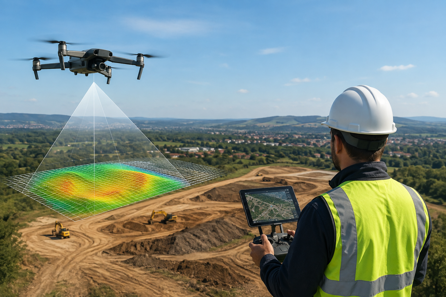
A land survey drone is an unmanned aerial vehicle equipped with LiDAR sensors, high-resolution cameras, or both, flown on a programmed route to capture precise spatial data across a site. Instead of a crew walking a property line with a total station over several days, a drone can cover dozens or even hundreds of acres in a single flight, generating a dense point cloud and georeferenced imagery that’s ready to drop into CAD, GIS, or BIM software.

The output isn’t just a pretty aerial photo. It’s measurable data — elevation, boundary lines, topography, vegetation cover, and existing structures — all tied to real-world coordinates. That’s what makes it useful for surveyors, engineers, and land planners rather than just a marketing tool.

Why Land Survey Drones Are Reshaping Mapping

Traditional land mapping relied on ground crews physically walking a site with GPS rovers or total stations, then feeding that data back for manual processing. It worked, but it was slow, labor-intensive, and limited by what a person could physically access — dense brush, steep slopes, wetlands, and large acreage all added time and cost.

Land survey drones remove most of those constraints. A single operator can map terrain that would take a ground crew days to cover, and LiDAR-equipped drones can even penetrate tree canopy to capture bare-earth elevation data that ground crews might miss entirely. For large-scale mapping projects — utility corridors, agricultural land, floodplain studies — this shift in capability has changed what’s realistically achievable on a normal project timeline.

Land Survey Drones in Construction Workflows

Construction teams use land survey drones at nearly every phase of a project:

  • Pre-construction site assessment — establishing existing topography and site conditions before design work starts
  • Cut-and-fill and grading calculations — comparing current terrain against design grades to plan earthwork
  • Progress monitoring — repeat flights that track construction progress against schedule, often on a weekly or monthly cadence
  • As-built verification — confirming that completed work matches approved plans
  • Stockpile and volumetric measurement — calculating material volumes without manual measurement

Because the data comes from the same coordinate system across every flight, teams can overlay surveys from different phases and see exactly what’s changed — something that’s far harder to do consistently with traditional spot-check surveying.

Drone Boundary Survey Price: What Affects the Cost

One of the most common questions property owners ask is simple: what does a drone boundary survey price actually look like compared to conventional methods? The answer depends on a handful of factors — site size, terrain complexity, whether ground control points need to be established, vegetation density, and the level of legal certification required for the final deliverable.

Indicative Drone Boundary Survey Price Comparison

Survey Method

Typical Cost Range

Typical Timeline

Traditional Ground Boundary Survey

$500 – $2,000 (small lots) / $5,000+ (large parcels)

1–2 weeks

Drone Boundary Survey (LiDAR/Photogrammetry)

$400 – $3,500 depending on acreage

1–3 days

Combined Drone + Ground-Truth Survey

$1,500 – $5,000+

3–5 days

For most residential and small commercial parcels, drone boundary surveys come in at or below traditional pricing while cutting turnaround time significantly. Larger, more complex parcels — heavy tree cover, irregular terrain, or contested boundary lines — may still need a combined approach with ground-truthed control points to meet legal survey standards.

Property Boundary Surveys Technology: LiDAR vs. Photogrammetry

Not all drone boundary surveys use the same underlying technology, and the choice matters for accuracy.

Photogrammetry stitches together overlapping high-resolution photos to build a 3D model of the surface. It’s cost-effective and works well on open, clear terrain, but it struggles to see through vegetation — it maps the top of the tree canopy, not the ground beneath it.

LiDAR sends out laser pulses that can pass through gaps in foliage and measure the bare-earth surface directly, which makes it the stronger choice for wooded lots, dense brush, or any parcel where canopy cover would otherwise hide the true ground line. LiDAR also tends to deliver tighter vertical accuracy, which matters for boundary and elevation-sensitive work.

Most property boundary survey technology providers today, including our team, choose the sensor based on site conditions rather than defaulting to one method for every job.

Accuracy and Deliverables

With ground control points properly established, land survey drones can achieve horizontal and vertical accuracy in the 1–5 cm range — sufficient for legal boundary documentation, engineering design, and permitting submissions. Standard deliverables typically include:

  • Georeferenced orthomosaic imagery
  • 3D point cloud (LAS/LAZ format)
  • Digital elevation and surface models (DEM/DSM)
  • CAD-ready boundary and topographic line work (DWG/DXF)

These files integrate directly into the software surveyors, civil engineers, and architects already use, avoiding the manual re-entry and file conversion that slows down traditional survey handoffs.

Choosing a Land Survey Drone Provider

Before hiring a provider, it’s worth confirming a few basics: FAA Part 107 certification for the pilot, access to LiDAR-equipped aircraft (not just photogrammetry drones) for wooded or complex terrain, in-house data processing for accountability and faster turnaround, and — critically for boundary work — involvement of a licensed land surveyor to certify the final boundary product where legally required. A drone captures the data; a licensed surveyor is often still needed to stamp it for legal use.

Final Thoughts

Land survey drones have moved from a novelty to a standard tool in mapping and construction, and for good reason — they cover more ground, in less time, at a lower cost than most traditional methods, while producing data that plugs directly into modern design and engineering workflows. Whether you’re planning a subdivision, verifying a property line, or tracking a construction project through every phase, the technology now exists to get that data faster and more affordably than ever.

At Skyelink’s Drone Lidar Mapping division, we work with property owners, developers, and contractors nationwide to deliver exactly this kind of survey data — accurate, fast, and ready for whatever comes next in your project.

Frequently Asked Questions

What is a land survey drone used for?

A land survey drone captures aerial LiDAR or photogrammetric data to produce boundary lines, topography, elevation models, and site imagery for construction, planning, and legal survey purposes.

Drone boundary survey price typically ranges from $400 to $3,500 depending on parcel size, terrain, and vegetation density, generally coming in at or below traditional ground survey costs for comparable accuracy.

Yes, when the data is reviewed and certified by a licensed land surveyor. The drone collects the raw spatial data; certification for legal use still requires professional sign-off in most jurisdictions.

With properly placed ground control points, drone-based boundary surveys typically achieve 1–5 cm accuracy, meeting standards required for legal documentation and engineering design.