Objective
This article explains why property owners across the US are choosing drone building surveys over traditional inspection and survey methods. It covers the key benefits — from speed and safety to cost and data quality — and explains how drone land surveying is changing the way buildings and structures are assessed. It also explores drone topographic survey cost comparisons and helps readers understand what to expect when commissioning a drone building survey. Readers will leave with a clear picture of which property types benefit most, what the data includes, and how to choose a qualified provider.
Key Takeaways
-
- Drone land surveying removes the need for scaffolding, rope access, and working-at-height permits.
- LiDAR-equipped drones achieve 2–5 cm accuracy — sufficient for engineering, planning, and BIM.
- Drone topographic survey cost is consistently lower than traditional ground or rope-access methods.
- A single flight produces data usable by architects, engineers, planners, and insurers simultaneously.
- Repeat surveys create a georeferenced building condition record across the asset’s full lifecycle.
- A drone building survey captures full structural data in hours — not days.
Introduction
At Drone Lidar Mapping, we work with property owners, developers, and contractors across the US on building survey projects ranging from single commercial units to large multi-site portfolios. The question we hear most often before any project starts is:
This guide answers that question from seven different angles — covering every major reason our clients have made drone surveys their default approach.
Table of Contents
- Introduction
- What Is a Drone Building Survey?
- Reason 1: Speed That Traditional Methods Cannot Match
- Reason 2: Safe Access to Hazardous and Hard-to-Reach Areas
- Reason 3: Centimetre-Level Accuracy for Engineering and Planning
- Reason 4: Lower Cost Than Scaffolding or Rope-Access Surveys
- Reason 5: Data That Works Across Every Discipline
- Reason 6: Zero Disruption to Building Occupants and Operations
- Reason 7: A Permanent, Repeatable Condition Record
- Which Property Types Benefit Most?
- How to Choose the Right Drone Survey Provider
- Final Thoughts
- Frequently Asked Questions (FAQs)
What Is a Drone Building Survey?
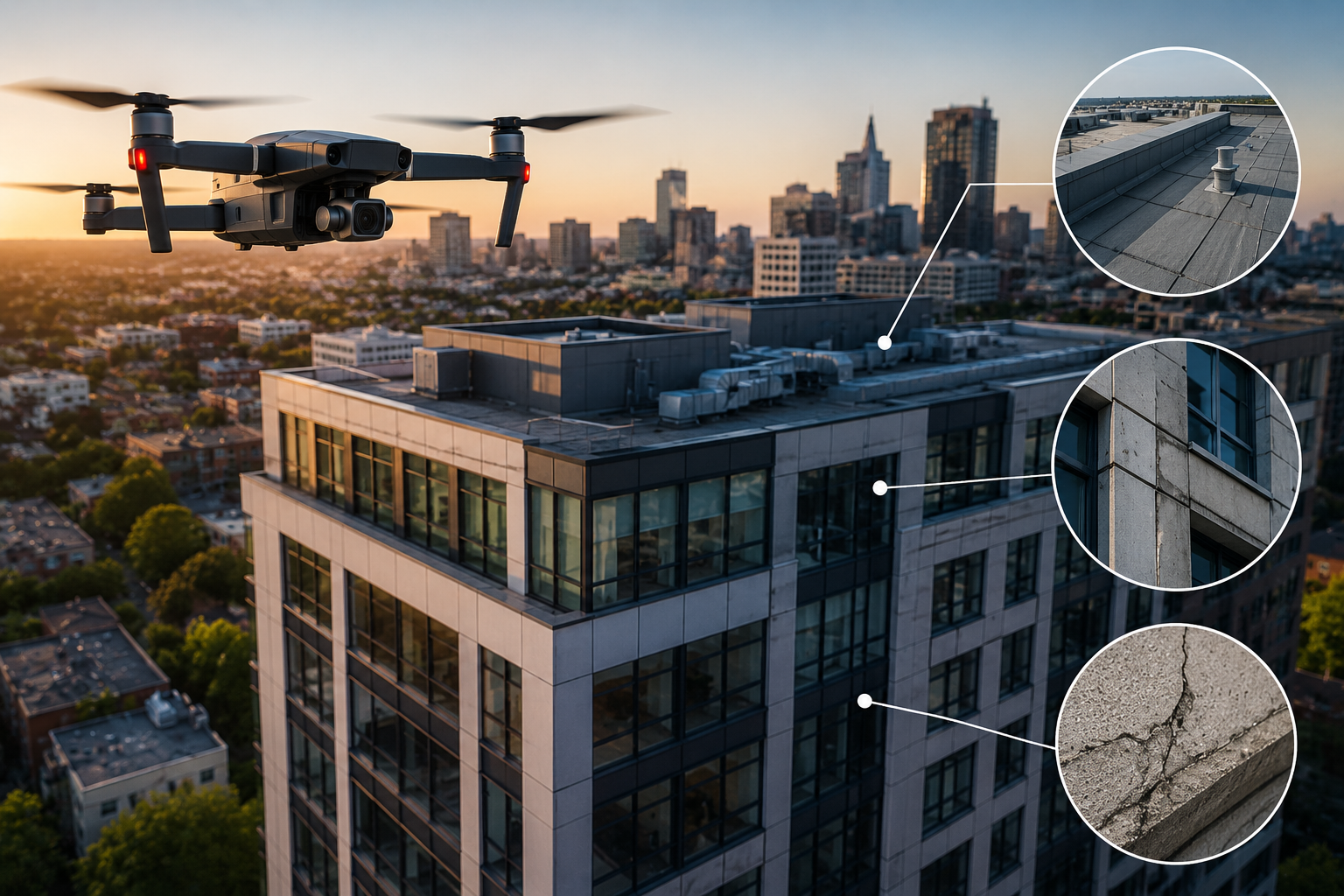
The drone flies a pre programmed route around the building, collecting millions of data points, per second. It outputs a 3D point cloud and an orthoimage dataset so engineers, architects, and planners can work with it straight inside CAD, BIM, and GIS tools. In a way it’s like, you can just keep using the same record, without redoing everything.
The deliverables usually cover digital elevation models (DEMs), georeferenced orthomosaic imagery, 3D mesh models, and condition reports that link back to exact coordinates on the structure. Compared with a simple written inspection or a handful of photos, this information is searchable and consistent. the same reference points can be re-visited in later surveys to measure shifts over time, rather than guessing.
Reason 1: Speed That Traditional Methods Cannot Match
A conventional building survey with scaffolding or rope access crews can take days to mobilize before any one measurement actually gets logged. It’s basically all set up first, like arranging access structures, lining up working-at-height permissions, and then getting the site teams briefed, and somehow it all eats time before the survey portion really starts.
For property owners, especially when there are planning deadlines, pre-sale schedules, or a current construction plan already running, that delay has a pretty clear financial effect. Quicker data leads to quicker decisions, earlier contractor getting on site, and overall less cost to keep the project going while it’s waiting, which adds up in the end.
Reason 2: Safe Access to Hazardous and Hard-to-Reach Areas
Roof edges, parapets, high facade panels, and structural parts close to brittle or maybe unstable materials can be risky for manual inspection crews. Usually the old kind of surveys make those people go up at height , and then you get all that extra planning permitting and insurance stuff that comes along with it, like you can’t really dodge it.
For industrial buildings, heritage architecture, active high-rise sites, and buildings next to busy roads or places with restricted access, this is not only a matter of convenience. It’s often the only route to collect the full exterior dataset without generating unacceptable danger to nearby people or day to day operations.
Reason 3: Centimetre-Level Accuracy for Engineering and Planning
Modern drone building surveys that use LiDAR sensors can reach vertical and horizontal accuracy of about ±2–5 cm when ground control points are set up properly. In practice that sort of precision is enough for a few very different, but related tasks like, structural condition appraisals and even deformation monitoring, planning submissions for permits and heritage paperwork, and then as-built verification in comparison to original architectural drawings. It also helps with BIM model integration plus clash detection workflows, and of course volume calculations for demolition ranges, extension work, or remediation efforts.
Reason 4: Lower Cost Than Scaffolding or Rope-Access Surveys
Consider what is removed from the project budget when a drone is used: scaffolding hire and labour, rope-access team day rates, working-at-height permits, extended site access periods, and the additional programme time that manual teams require. Drone surveys eliminate most of those line items.
Indicative Building Survey Cost Comparison
| Survey Method | Typical Cost Range | Typical Timeline |
| Rope Access / Scaffolding Survey | $5,000 – $25,000+ | 5–15 days |
| Manual Ground Survey (exterior only) | $2,000 – $8,000 | 2–5 days |
| Drone Building Survey (LiDAR) | $1,200 – $6,000 | Same day – 2 days |
Reason 5: Data That Works Across Every Discipline
Standard deliverables include:
High-Resolution Orthomosaic Imagery
Georeferenced photographic coverage of the full building exterior, usable in GIS platforms and for visual condition reporting.
3D LiDAR Point Cloud
Compatible with AutoCAD, Revit, Bentley MicroStation, and ArcGIS — ready to import into existing BIM or engineering workflows without file conversion.
Digital Surface Models (DSM) and Digital Elevation Models (DEM)
Essential for drainage analysis, flood risk assessment, and any project requiring precise elevation data across the site and structure.
Thermal Imaging Overlays (Where Applicable)
For buildings where insulation performance, moisture ingress, or heat loss is under assessment, thermal camera payloads can be integrated into the same flight.
Architects, structural engineers, planning departments, and insurance assessors can all work from the same core dataset — eliminating duplication of effort and resolving discrepancies that often arise between survey outputs from different teams working at different times.
Reason 6: Zero Disruption to Building Occupants and Operations
Property owners often underestimate the operational impact of traditional building surveys. A roof inspection requiring scaffolding affects access routes, requires coordination with building tenants, and may trigger insurance notifications or temporary building closures.
This is particularly valuable for:
- Occupied commercial buildings and multi-tenancy retail properties
- Schools, hospitals, and public buildings where access is restricted and safety protocols are strict
- Historic and listed buildings where physical contact with fabric must be minimised
- Live construction sites where introducing additional personnel creates programme conflicts
Reason 7: A Permanent, Repeatable Condition Record
A drone building survey does not just solve today’s inspection requirement — it creates a baseline dataset that retains value across the building’s full lifecycle.
Annual or biannual repeat flights over the same reference points allow property owners and facilities managers to:
-
Track structural movement, settlement, or deformation against the original capture
-
Identify facade cracks, spalling, or material deterioration early — before reactive repair becomes unavoidable
-
Support insurance claims with pre-existing and post-event condition data
-
Satisfy lender or investor due diligence requirements on asset condition
-
Build a documented maintenance record that supports property valuation and sale
Unlike a written inspection report, the point cloud and imagery from a drone building survey are georeferenced and queryable. Any point on the structure can be revisited years later and compared against the original data — a capability no manual survey method can replicate at comparable cost or scale.
How to Choose the Right Drone Building Survey Provider
Not all drone survey companies operate to the same standard. Before commissioning work, confirm the following:
FAA Part 107 certification — required for all commercial UAV operations in the US. Verify the certificate before work begins.
LiDAR-equipped aircraft — not just photogrammetry drones — for structural survey work requiring dimensional accuracy at engineering grade.
In-house data processing and quality control — rather than outsourced processing, which reduces accountability and extends turnaround time.
Delivery in standard professional file formats — LAS/LAZ for point clouds, GeoTIFF for orthomosaics, DXF/DWG for CAD-ready structural outputs.
Written deliverable specifications before work starts — covering file formats, coordinate system, accuracy targets, and delivery timeline.
Final Thoughts
The drone building survey has moved from a niche capability to a standard professional tool — and for good reason. It delivers faster, safer, and more cost-effective building data than any traditional method, with outputs that integrate directly into the platforms your engineers, architects, and planners are already using.
For property owners looking to reduce inspection risk, improve planning accuracy, cut programme timelines, or build a reliable long-term record of their assets, it represents one of the most straightforward and highest-returning investments available in the current market.
Whether your project is a single commercial building, a heritage site, or a large-scale development, the data quality and cost efficiency of a drone building survey makes it the logical first choice.
[call-to-action] Ready to Discuss Your Project? Contact Us → dronelidarmapping.com/contact-us/
Frequently Asked Questions
What is a drone building survey?
How accurate is a drone building survey?
Do I need permission for a drone survey of my building?
How long does a drone building survey take?
A drone building survey uses UAV-mounted LiDAR sensors or cameras to capture 3D point cloud data, orthomosaic imagery, and dimensional measurements across a structure’s exterior. The output supports structural assessment, planning applications, BIM integration, and condition monitoring — without scaffolding or physical access to the building fabric.
With LiDAR sensors and properly established ground control points, drone building surveys achieve 2–5 cm vertical and horizontal accuracy — meeting requirements for structural engineering, heritage documentation, as-built verification, and BIM integration.
In most cases, no. Commercial drone surveys operate under FAA Part 107 regulations and do not require individual planning permission. Your survey provider handles any required airspace notifications or authorisations as part of their standard operational workflow.
Flight time for most structures ranges from two to six hours depending on building size and complexity. Processed deliverables are typically available within 24 to 48 hours of the flight completing — compared to several days or weeks for equivalent traditional survey methods.