If you’re trying to figure out which drone can actually produce reliable topographic data, here’s the thing: most people judge a drone by the camera or the flight time, but topographic mapping is a different game. You’re not just collecting nice aerial photos. You’re taking precise ground information, including contours, slopes, terrain, along elevation markers that land developers, engineers, and surveyors rely upon.
Did you know recent industry research shows that high-accuracy drone mapping can cut survey time by more than 60% while still matching the precision of traditional methods when proper sensors and workflows are used? That’s one reason so many professionals now use a topographic mapping drone for everything from land planning to construction groundwork.
Before we go deeper, let’s quickly outline what this blog will help you with.
Key Takeaways
- You’ll understand what makes a drone truly capable of topographic work.
- You’ll learn which features matter most for accuracy and consistency.
- You’ll see how professionals (like the team at Drone LiDAR Mapping) handle these surveys in real-world conditions.
- You’ll get practical pointers that help you make a smart buying or outsourcing decision.
Understanding Modern Tools Used in Topographic Mapping
Let’s break it down. Topographic mapping relies on more than a drone with good specs. It’s a combination of aerial data, precise sensors, ground control, and processing workflows.
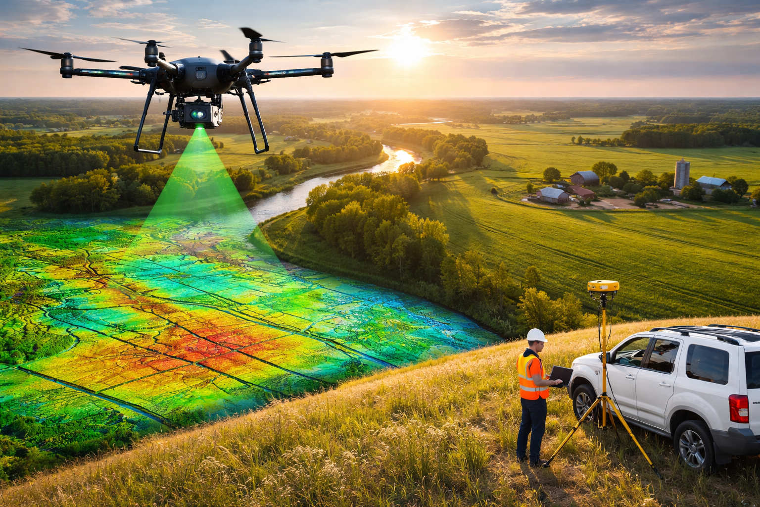
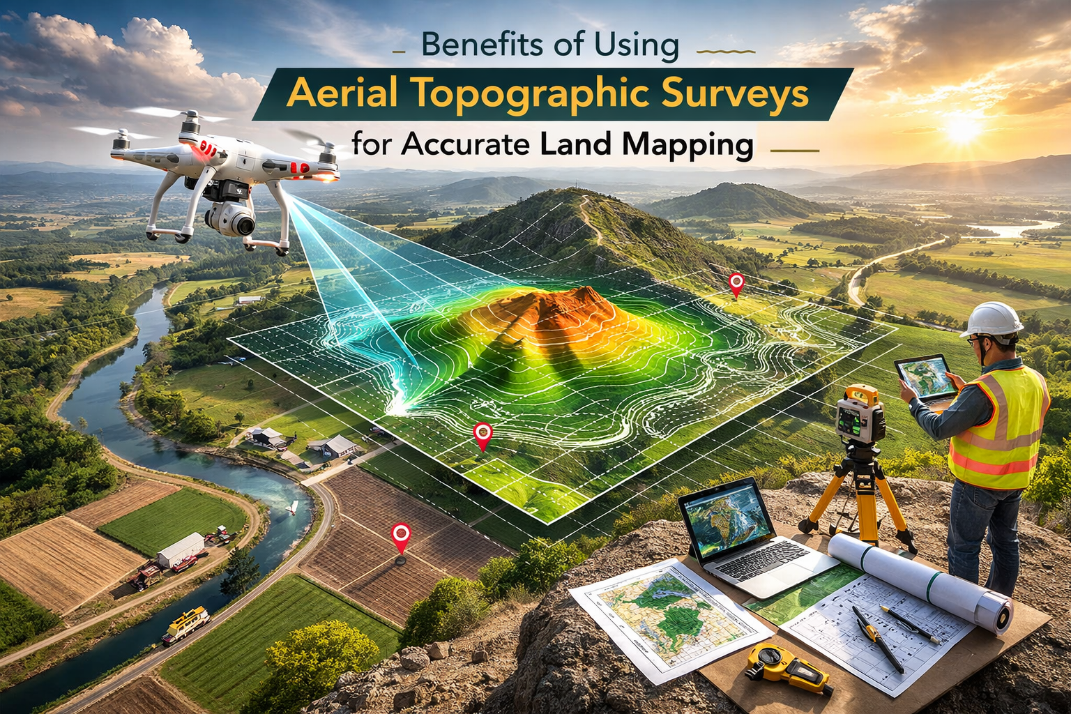
How an aerial topographic survey works
An aerial topographic survey uses a drone to gather surface data that represents the terrain. With LiDAR or photogrammetry systems, the drone collects elevation points, which are then turned into:
- Contour lines
- Digital elevation models
- Orthomosaic views
- 3D terrain models
These are the same deliverables you see offered on DroneLiDARMapping.com, where the team creates accurate ground models for land development, ALTA/NSPS surveys, construction planning, and environmental studies.
Why industries depend on drone-based mapping
Here’s what this really means for you:
- Faster site coverage
- Reduced field crew time
- Safer access to rough terrain
- More consistent data
As one well-known geospatial specialist recently said, “Drone surveys don’t replace the surveyor. They help the surveyor finish faster with better data.” That sums it up well.
Key Features to Look for When Choosing a Drone for Topographic Mapping
Not all drones can produce survey-grade results, even if the marketing says they can. If your objective is to obtain precise terrain information, the features you choose to use are crucial.
1. Sensor type: LiDAR vs. photogrammetry
LiDAR sensors detect laser pulses, and they can read ground conditions even in trees. This is the reason why professional teams use LiDAR to map dense areas. Photogrammetry can still be useful for open spaces as well as earthwork, real estate, and mapping property.
To make this easier, here’s a quick comparison:
| Feature | LiDAR | Photogrammetry |
| Works under vegetation | Yes | No |
| Best for terrain accuracy | Yes | Good |
| Best use case | Forests, rough terrain | Open land, buildings |
| Cost | Higher | Lower |
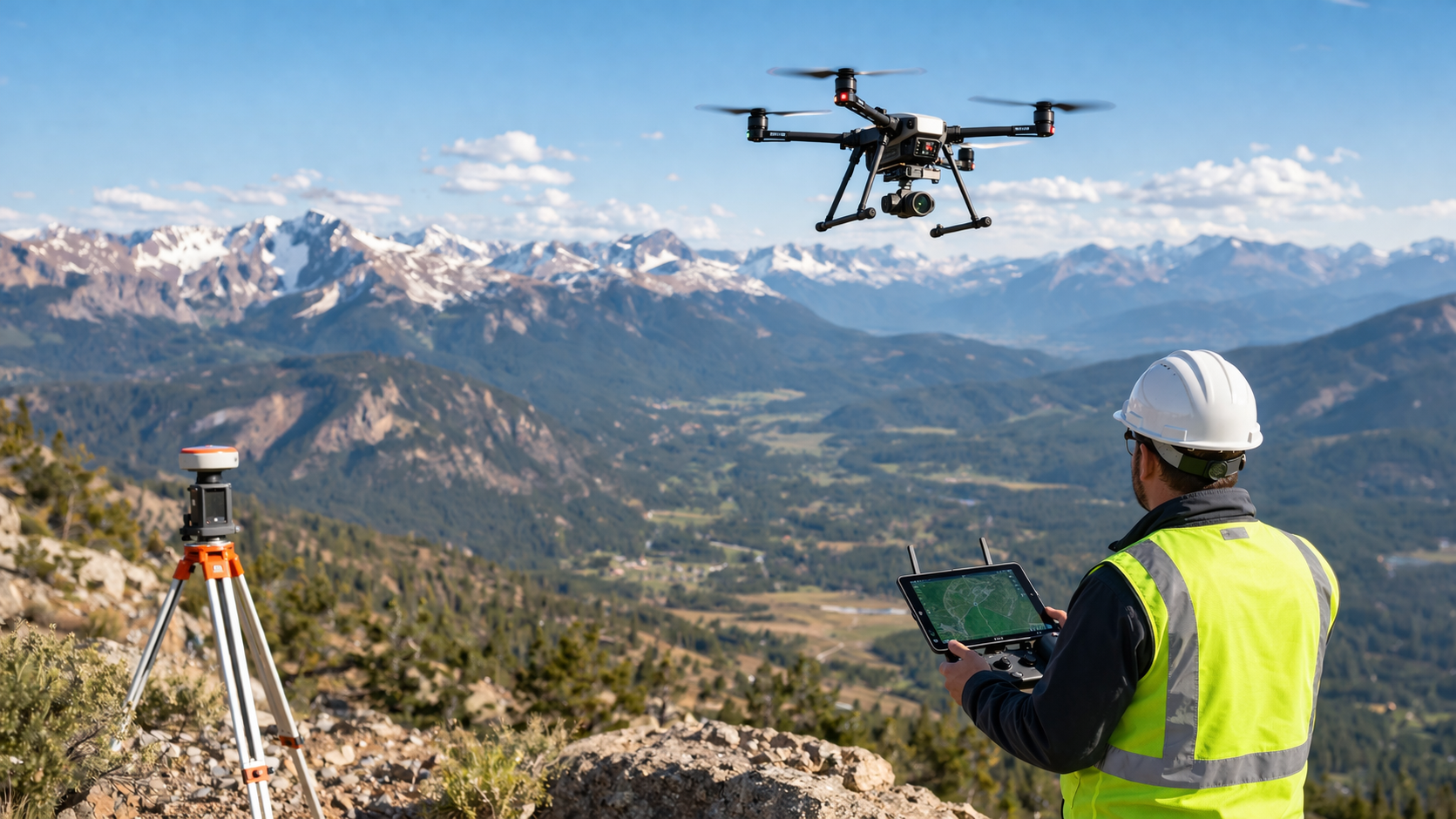
2. Flight endurance and range
If a site is large, you need a drone that can stay up long enough to complete the mission. Long flight endurance also reduces gaps in data and the need for stitching too many flight paths.
3. GNSS accuracy with RTK or PPK
Here’s the thing: without precise positioning, even the best drone won’t give correct elevations. RTK and PPK technology help the drone maintain centimeter-level accuracy.
This is also how the team behind drone topographic survey services at Drone LiDAR Mapping achieves reliable ground models for engineers and surveyors who depend on exact control points.
4. Payload capacity and stability
High-accuracy sensors are heavier. Your drone must support the weight while staying stable in the air. Stability also plays a big role in capturing smooth LiDAR point clouds.
How Professional Drone Services Ensure Reliable Topographic Results
You might be thinking, “Should I just buy a drone or hire a team that already has everything dialed in?” Let’s look at how professionals get it right.
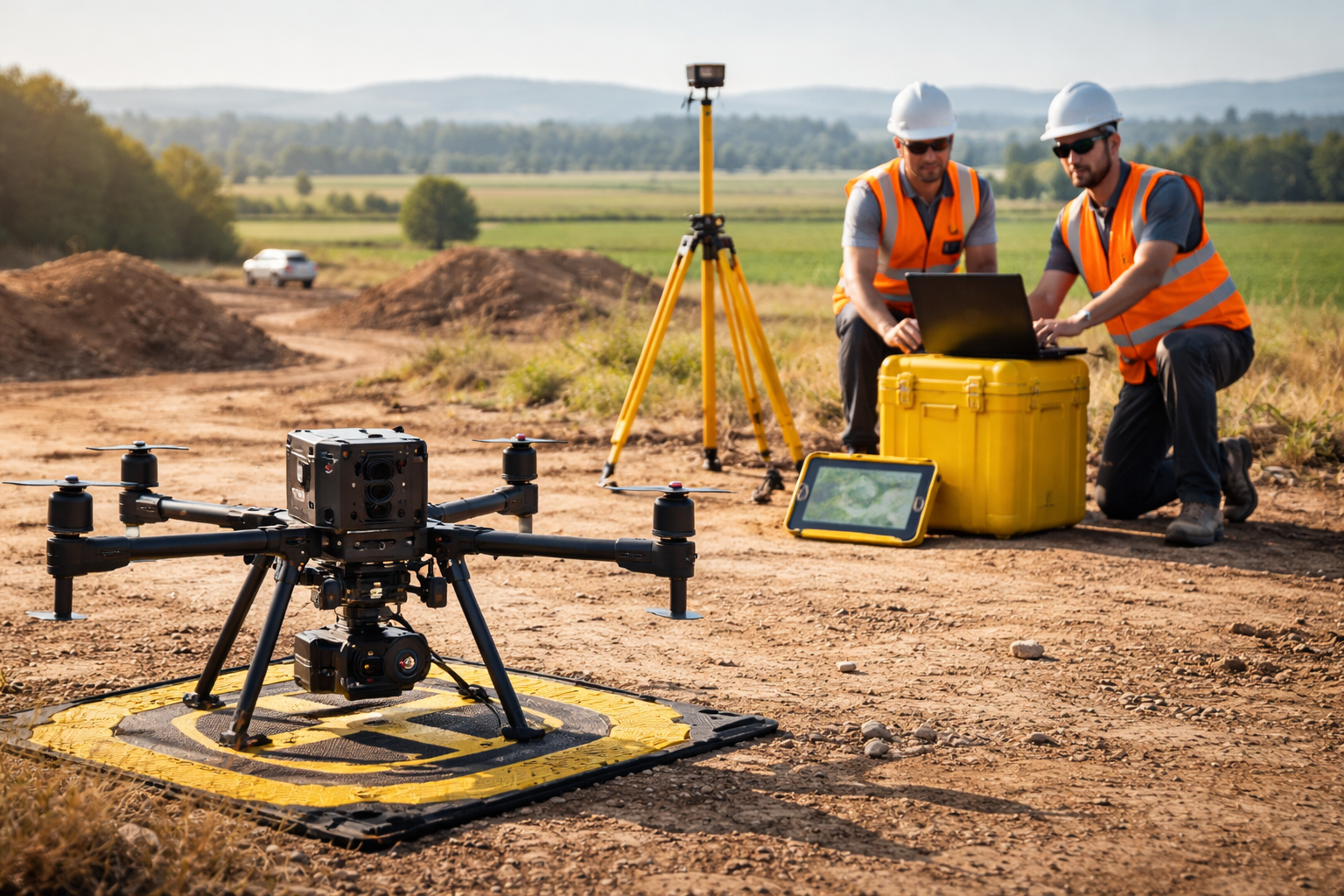
A real-world example from the site workflow
Imagine a land development project where the property has uneven ground, wooded patches, and slopes. A typical job at Drone LiDAR Mapping starts with:
- A flight plan
- Setting up ground control
- Running LiDAR passes
- Processing millions of elevation points
- Creating DEMs and contours
- Delivering ready-to-use CAD files
This type of workflow is what sets professionals apart in terms of accuracy and speed.
The deliverables that matter
Every client expects a clear output. The most important ones are:
- Digital elevation models
- Contour maps
- Orthomosaic views
- Ground surface models
- 3D terrain representations
These deliverables help engineers design roads, foundations, utilities, and site layouts.
When outsourcing beats buying
A survey-grade drone with LiDAR can cost as much as a work truck. Add training, software, field experience, and FAA requirements, and the learning curve grows. In that case, outsourcing to experts offering drone topographic survey services can be the smarter route.
Choosing the Best Tools for Topographic Work: A Practical Buying Guide
If you’re still leaning toward purchasing your own system, here’s what to focus on.
Quick checklist for evaluating a mapping drone
- Excellent sensor performance (LiDAR is preferred for dense vegetation)
- Accurate GNSS reliability using RTK/PPK
- Long flight time
- Good payload support
- Compatible to use mapping software
- Ability to handle websites with a slope as well as mixed terrain
Comparing drone types
- Compact drones
- Great for quick checks or small projects.
- Enterprise mapping drones
- Better sensors, more stability, better results.
- Heavy-lift LiDAR drones
- Best for survey-grade accuracy and large sites.
Each category has its place, but only enterprise and LiDAR platforms produce the precision expected by surveyors and engineers.
Ready to Map with Confidence? Here’s Your Best Next Step
By now, you know that choosing the right topographic mapping drone isn’t just about finding a popular model. It’s about understanding sensors, flight performance, accuracy tools, and the type of terrain you need to map.
If you want your data to be dependable enough for land planning, design work, or ALTA-level surveying, choose equipment that delivers true elevation accuracy or work with a team that already has it. Companies like Drone LiDAR Mapping bring the right tools, experience, and workflows to deliver trusted ground models for construction, real estate, civil engineering, and environmental needs.
FAQs
What makes a drone suitable for topographic mapping?
You need strong sensors, stable flight performance, good GNSS accuracy, and proper ground-control workflows.
Is LiDAR better than photogrammetry for terrain mapping?
LiDAR performs better on sites with vegetation and uneven ground. Photogrammetry is great for open sites.
How accurate are aerial topographic surveys?
With quality GNSS tools and proper control, accuracy can reach the centimeter range.
Do I need special licensing to fly a mapping drone?
Yes. In the U.S., commercial drone pilots must hold FAA Part 107 certification.
What is the best drone for topographic survey work?
Survey-grade LiDAR platforms deliver the most reliable terrain models.
How long does data processing usually take?
Most projects are processed within a few hours to a couple of days, depending on size and complexity.