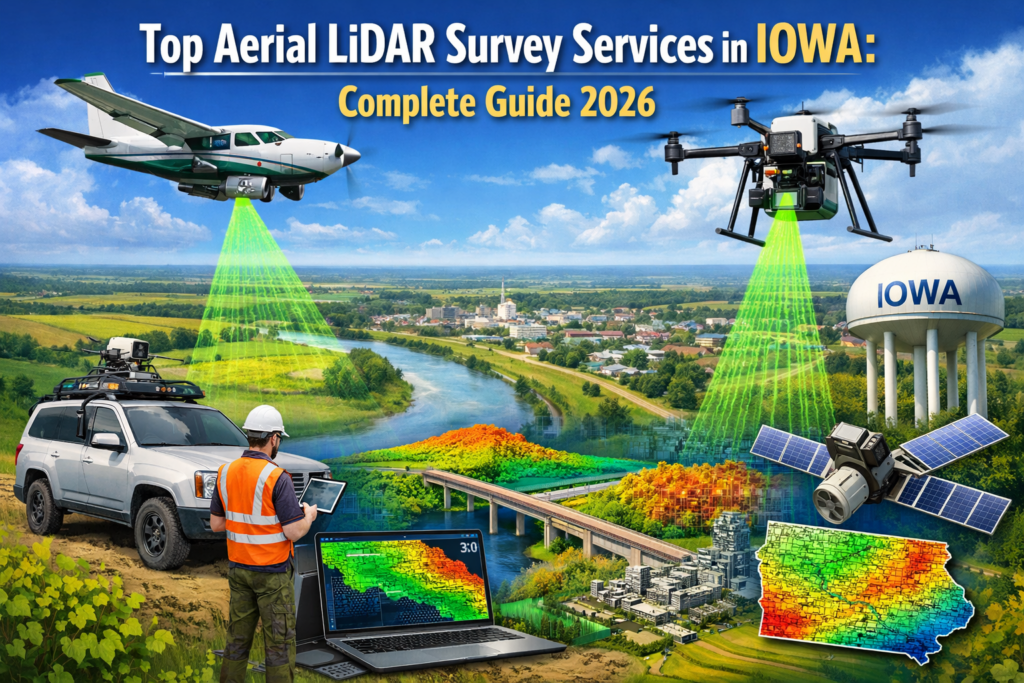
Objective
The objective of this guide is to explain how aerial LiDAR surveys work in Iowa and how to pick the right provider for the job in 2026. For land, infrastructure, and development projects, we breakdown accuracy, costs, workflows, and real-life use cases.
Key Takeaways
- Drone‑based LiDAR cuts field time while increasing safety
- High‑density data supports surveying, engineering, and planning
- Costs vary by acreage, terrain, and deliverables, not guesswork
- Iowa projects benefit from LiDAR’s vegetation‑penetration ability
Introduction
What if you could map hundreds of acres with survey‑grade accuracy in a single day, without sending crews into the field?
Land surveying across Iowa has shifted rapidly in the last few years. What once took weeks of ground work can now be done in hours using drones equipped with LiDAR sensors. For many professionals, searching for aerial LiDAR survey services in Iowa means one thing: dependable accuracy delivered faster and safer than traditional methods.
Did you know? Modern drone‑based LiDAR systems can collect millions of elevation points every second, creating dense point clouds that capture bare‑earth detail even beneath heavy vegetation, something photogrammetry and many ground methods struggle to achieve.
At its core, aerial LiDAR uses laser pulses to measure distance from the air, producing precise 3D terrain data. In this complete 2026 guide, we explain how it works in Iowa, where it adds value, what it costs, and how to select the right service partner.
Table of Contents
- What Are Aerial LiDAR Survey Services?
- How Drone LiDAR Mapping Works in Iowa
- Key Benefits for Iowa Projects
- Drone LiDAR vs Traditional Survey Methods
- Common Use Cases Across Iowa Industries
- Understanding Cost Factors in 2026
- How to Choose the Right LiDAR Provider
- Frequently Asked Questions
- Clear Data, Better Decisions
- Call to Action
What Are Modern Aerial LiDAR Surveying Solutions in Iowa?
With aerial LiDAR surveying, laser scanners are mounted on unmanned aircraft to determine structures, terrain, and vegetation. With every laser return, a precise 3D image of the area is created by following a predetermined flight path.
These solutions are widely used for topographic mapping, corridor surveys, and large‑area assessments where speed and safety matter.
How LiDAR Mapping Works in Iowa Terrain
LiDAR sensors emit laser pulses toward the ground. The software calculates distances based on timing and GPS corrections once those pulses return. LiDAR can detect bare-earth elevations even in wooded areas because many pulses pass through vegetation gaps.
Why Aerial Mapping Services USA Supports State Projects
Large-scale projects typically require the sameness across counties or regions. Companies that offer aerial mapping services across the USA can scale their operations as well as maintain data standards and provide consistent outputs across jurisdictions.
How Drone‑Based LiDAR Mapping Works on Iowa Projects
LiDAR is powerful, but it requires a disciplined workflow to produce results. From planning to delivery, Iowa projects follow a clear process.
How LiDAR Mapping Works in Iowa Step by Step
- The flight plan is based on the area, terrain, and the accuracy required
- Capture of data by using RTK/PPK position for precise position
- Processing and classifying in order to differentiate vegetation, ground, and structures
- Deliverables like DTMs and contours, as well as point clouds
The Role of Drone Surveying Companies Iowa Relies On
Licensed pilots and experienced processors matter. Drone surveying companies that Iowa professionals trust follow FAA regulations and incorporate outputs into engineering and survey software.
Key Benefits of Using Drone LiDAR in Iowa
Drone LiDAR is a solution to many issues that plague the Midwest, like the common issues of vast tracts of land, variable terrain, that is variable and the amount of vegetation.
Accuracy and Speed Advantages for Large Sites
- Dense point clouds capture subtle grade changes
- Hundreds of acres could be mapped in one day
- Repeat surveys support change analysis
Why LiDAR Mapping Services Near Iowa Improve Safety
Keeping crews off steep slopes, roadways, or marshy ground reduces risk. LiDAR mapping services near Iowa allow data collection without extensive ground access.
Drone LiDAR vs Traditional Survey Methods
Choosing the right approach depends on project scope. A side‑by‑side view helps teams decide.
Drone LiDAR vs Traditional Survey Iowa Projects
- Time: Drone LiDAR gathers data faster
- Coverage: Aerial surveys capture entire sites uniformly
- Safety: Less exposure to hazards
When Ground Surveys Still Play a Supporting Role
- Legal boundary monumentation
- Final staking or verification
- Small, detail‑heavy areas
Common Use Cases for Aerial LiDAR Surveys in Iowa
LiDAR supports a wide range of projects across the state.
Land Development and Construction Planning
Topographic mapping, cut‑and‑fill volumes, and site grading models benefit from LiDAR precision.
Infrastructure, Utilities, and Environmental Projects
Corridor mapping for roads, drainage studies, flood analysis, and vegetation management all rely on accurate elevation data.
Example: A rural Iowa development used drone LiDAR to map a mixed agricultural site with tree cover. The team identified drainage paths early, avoiding design changes later.
Understanding the Cost Structure in 2026
Pricing isn’t one‑size‑fits‑all. Several factors influence quotes.
Cost of LiDAR Survey Services in Iowa Explained
- Size of the area
- Terrain complexity
- Required accuracy and deliverables
How aerial lidar survey services in Iowa compare over time
When you compare labor savings and reduced re‑survey risk, aerial lidar survey services in Iowa often provide strong long‑term value.
A Practical Cost Comparison Table
| Factor | Drone LiDAR Survey | Traditional Ground Survey |
| Field time | Short | Long |
| Crew exposure | Low | Higher |
| Coverage | Wide area | Point‑based |
| Data density | Very high | Moderate |
How to Choose the Right Aerial LiDAR Provider
Not all providers deliver the same quality. Selection matters.
What to Look for in Drone Surveying Companies Iowa Professionals Trust
- Proven accuracy standards
- Clear deliverables
- Experience with Iowa terrain
Why Experience with Aerial Mapping Services USA Matters
Providers with a wealth of experience use consistent workflows and have a reliable quality control system across projects, regardless of whether they are local or across the state.
Clear Data, Better Decisions
Accurate terrain data drives better outcomes. If teams are aware of the project’s conditions in advance, they avoid delays, redesigns, and risks to safety. Assessing airborne LiDAR surveys in Iowa involves considering more than speed, but long-term benefits of the project.
Collaboration with experienced partners from Drone LiDAR Mapping ensures high-quality data, efficient workflows, and reliable results. For a variety of Iowa projects, aerial LiDAR surveying services in Iowa have been a useful base for modern-day surveying.
Frequently Asked Questions
How accurate are drone LiDAR surveys in Iowa?
With proper control and processing, drone LiDAR delivers survey‑grade accuracy suitable for engineering and planning workflows.
Is LiDAR suitable for wooded or vegetated areas?
Yes. Laser pulses penetrate canopy gaps, revealing bare‑earth terrain beneath foliage.
How long does an aerial LiDAR survey take?
Flights may last hours, while processing and classification typically take days, depending on the scope.
Do LiDAR surveys replace licensed surveyors?
No. LiDAR complements licensed survey workflows by providing detailed terrain data.


