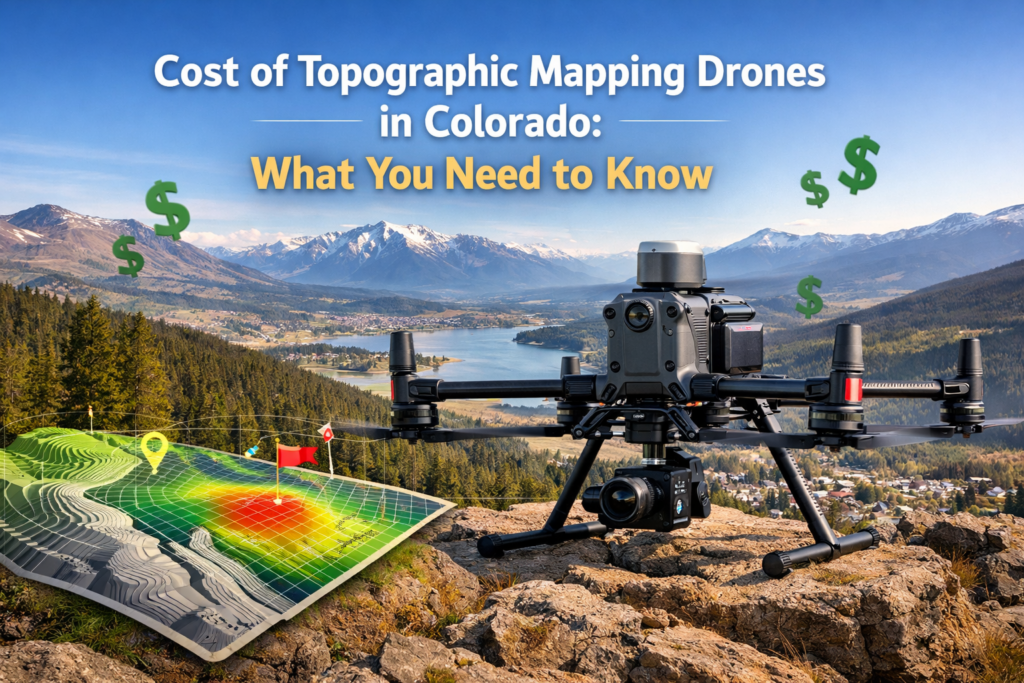
Objective
This guide is designed to help developers, surveyors, engineers, and project managers understand what truly drives the cost of drone‑based topographic mapping in Colorado. By the end, you’ll know what affects pricing, how to budget accurately, and how to choose mapping services that deliver real value instead of unexpected expense.
Key Takeaways
- Drone mapping prices vary for valid technical reasons
- LiDAR costs more than basic photogrammetry, but adds value
- Per‑acre pricing rewards larger sites
- Processing and accuracy matter as much as flight time
Introduction
Topographic mapping costs usually feel confusing until you understand what’s actually behind the numbers. Many professionals assume pricing is based only on drone flight time, but that’s rarely the case. Drone surveying cost Colorado projects depend on terrain, data accuracy, technology choice, and processing requirements.
Did you know? Industry comparisons consistently show that drone‑based surveys can reduce mapping expenses by more than half compared to traditional ground surveys, especially across rugged or hard‑to‑reach Colorado terrain.
A topographic mapping drone uses advanced sensors, often LiDAR or high‑resolution imaging, to collect elevation data and surface detail from above. That data becomes contour maps, terrain models, and CAD‑ready files used for planning and design. Understanding what you’re paying for helps you avoid overspending while still receiving survey‑grade results.
Table of Contents
- Why Drone Mapping Costs Vary in Colorado
- Mapping Technologies and Their Price Impact
- Site Size and Terrain Complexity
- Per‑Acre Pricing Explained
- Equipment, Sensors, and Accuracy Requirements
- Processing, Compliance, and Expertise Costs
- Drone Mapping vs Traditional Surveying
- Frequently Asked Questions
- Smarter Budget Planning for Survey Projects
- Call to Action
Why Drone Mapping Costs Are Different From Project to Project
Drone mapping pricing isn’t fixed because no two sites are the same. The elevation, vegetation, terrain changes, and access conditions affect the way data is taken and processed.
Projects in Colorado often include:
- Mountain slopes
- Dense tree cover
- Zones that are remote or restricted
Each increases the time required and also the technical difficulty.
How Drone Topographic Survey Pricing Guide Colorado Projects Differ Across Sites
Costs vary based on:
- Accuracy expectations
- Ground control requirements
- Data density
This actually means that accuracy costs more initially, but can prevent costly errors later.
Understanding Drone Mapping Technologies and Their Cost Differences
Topographic mapping by drones primarily is based on two technologies: photography and LiDAR.
Photogrammetry employs overlapping photos to build models. It is less expensive, but it struggles in the midst of the cover of vegetation.
LiDAR makes use of laser pulses to penetrate foliage and is therefore ideal to be used on Colorado landscapes.
Cost of LiDAR Drone Survey in Colorado 2026 Explained
LiDAR adds expense because it requires:
- Advanced sensors
- More processing time
- Higher‑level expertise
However, it produces ground data that photogrammetry cannot.
Photogrammetry vs LiDAR for Budget Decisions
Photogrammetry works best for:
- Cleared sites
- Flat terrain
LiDAR is preferred when:
- Trees or brush obstruct the ground view
- Engineering‑level accuracy is required
Project Size and Terrain Have Major Pricing Impact
This is where the first body repetition of drone surveying costs in Colorado should be considered carefully. Larger sites often reduce price per acre, while smaller sites may appear more expensive per unit.
LiDAR Drone Survey Cost Per Acre in Colorado
Typical patterns include:
- Small sites: higher per‑acre rates
- Large sites: discounted acreage pricing
Mountain terrain often increases cost due to increased flight planning and processing needs.
Why Steep and Remote Areas Cost More to Map
Elevation change means:
- More flight passes
- Tighter data spacing
- Adds quality checks
How Per-Acre Pricing Actually Works
When it comes to large projects, per-acre pricing makes budgeting easier, but it also reflects the technical burden.
What Affects Topographic Survey Drone Price
Its key features include:
- Point density
- Deliverable formats
- Accuracy tolerance
It helps to keep prices fair and ensures quality.
Affordable Drone Mapping Colorado Options Without Cutting Corners
Cost control is derived from:
- A matching technology for the requirements of the site
- Eliminating unnecessary data collection
Skyelink provides the right tools for the job and doesn’t sell unnecessary features.
Equipment, Sensors, and Accuracy Standards
Better accuracy requires stronger sensors and advanced workflows.
Best Budget Mapping Drones for Surveyors USA
Entry‑level mapping drones work for simple sites. Survey‑grade projects require:
- LiDAR sensors
- RTK or PPK GPS
- Quality control stages
Why Accuracy Specifications Raise Cost
Higher accuracy demands:
- Ground control verification
- Precise calibration
- Extra processing time
Processing, Compliance, and Technical Experience
Flying the drone is only the first step. Data processing often represents the largest portion of the project effort.
Why Licensed Pilots and Survey‑Ready Workflows Matter
Licensed pilots:
- Ensure regulatory compliance
- Protect data integrity
Processing teams convert raw data into:
- Contours
- Elevation models
- CAD‑ready files
How Drone Topographic Survey Data Becomes Usable
Clean data requires:
- Classification
- Noise filtering
- Format standardization
This behind‑the‑scenes work directly impacts cost.
Drone Mapping vs Traditional Surveying Cost Comparison
This section includes the second body usage of drone surveying in Colorado.
Traditional surveys involve:
- Multiple field crews
- Longer schedules
Drone mapping reduces:
- Time on site
- Labour expenses
Cost Comparison for Large or Difficult Sites
Drone mapping often completes work in days rather than weeks.
When Ground Surveys Are Still Needed
Some boundary and legal work may still require traditional methods.
Cost Comparison Snapshot
| Method | Time Required | Access Difficulty | Approximate Cost Trend |
| Ground Survey | High | Limited | Higher |
| Drone Photogrammetry | Moderate | Flexible | Lower |
| Drone LiDAR | Moderate | Excellent | Mid‑range |
Smarter Budget Planning for Mapping Projects
Understanding pricing avoids surprises. Matching the site’s needs to the right mapping method saves money. That’s why working with teams like Skyelink through DroneLiDARMapping helps clients balance precision and cost without overpaying.
Conclusion
This final mention of drone surveying cost Colorado ties everything together. Pricing reflects more than flight time; it accounts for technology, processing, accuracy, and terrain. Once you understand those factors, budgeting becomes clear and predictable.


