Properly determining the lines of a property has never been more critical in real estate transactions, land development, and legal land disputes than it is now. For a long time, indeed, boundary surveys were characterized by manual measurements, the use of physical markers, and tons of fieldwork. Even though those methods were in use for several decades, they still were often slow, labor-intensive, and also considerably subject to human errors—especially in the case of uneven terrain or huge plots of land.
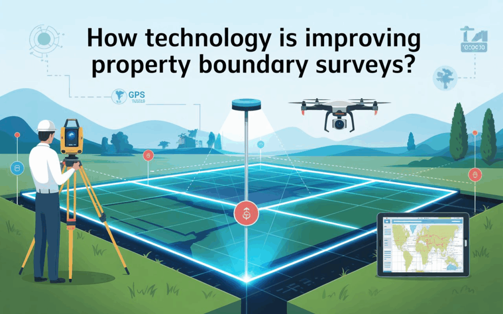
But technology indeed comes to the rescue, in a big way, by turning upside down the traditional way of conducting property boundary surveys by the professionals concerned. The advanced tools of GPS, GIS, and the most important of all, the land-surveying drones—these have brought about a new era of surveying where quick, accurate, and highly detailed results are now possible. Drone LiDAR Mapping, the company powered by Skyelink, is leading the way by using cutting-edge technologies that not only provide high precision but also high efficiency.
We have elaborated below how the new technological innovations are transforming and facilitating the property boundary surveys and the importance of these changes for landowners, builders, and real estate professionals.
1. Drone Technology Is Redefining Land Surveying
The application of land survey drones has been one of the great innovations in the domain of property surveying. These flying devices are capable of gathering aerial information with extremely high precision, even in challenging or dangerous spots.
Why Are Drone Surveys Better ?
Faster results: Traditional surveys can take days while a drone survey can finish the same area in just a few hours.
Superior accuracy: Imaging of very high quality together with the use of advanced sensors decreases the mistakes done by humans.
Safe and efficient: Drones can conveniently operate in hard-to-access areas such as steep slopes, dense forests, or places that are flooded.
Cost-effective: The lower the fieldwork costs, the more the total survey done using a drone will be affordable, which is why many clients opt for this type of survey.
All of these advantages for property owners boils down to a quicker decision-making process, better planning, and less time lost on construction or real estate projects due to waiting for surveying.
2. LiDAR Technology Offers Impeccable Accuracy
In the area of Drone LiDAR Mapping, we use LiDAR technology primarily which is Light Detection and Ranging. The technology sends out laser pulses that hit the ground and return to the sensor, thus making a detailed and accurate 3D model of the land virtually.
Advantages of LiDAR in Boundary Surveys
Accuracy even through dense vegetation
LiDAR has this unique power to penetrate trees’ canopies and vegetation revealing ground elevation that is completely out of sight to standard cameras.
High-density data points
Increased number of data points directly proportional to precision of boundaries which helps in conflict-free areas.
Ideal for complex terrain
It does not matter if the land is hilly or forested or not even; LiDAR provides reliable outcomes.
This degree of accuracy greatly aids the development and land planning industries as they are dependent on precise elevation and boundary info for the safe construction of their projects.
3. GPS and GNSS Enhance Location Accuracy
Surveyors have started to use drones and LiDAR along with modern-day GPS and GNSS systems. Such arrangements facilitate positioning of coordinates as accurately as just a few millimetres hence confirming that the boundary lines are drawn exactly where they are supposed to be.
Benefits
Lower danger of encroachment
More trustworthy property records
Better planning for fencing, footing, utilities, etc.
Combining different technologies results in survey outputs that are not only very clear but also legally secure.
4. Faster Delivery of Results With Digital Processing
Previously, surveyors would take hours to manually draw boundary maps and interpret field data. Nowadays, cloud-based software and automated processing tools speed up this stage considerably.
Modern Enhancements
Digital maps are ready within minutes
3D models make the boundary quite visible
Data is shared immediately with architects, engineers, and property owners
Clients no longer have to wait for their final report for weeks. The processing time at Skyelink for Drone LiDAR mapping is so fast that the waiting period is cut down drastically.
5. Reduced Cost Through Automation
A lot of clients think about the drone boundary survey price and guess that high-tech tools will mean more costs. But, to their surprise, the total cost of surveying is reduced by the automation.
How Technology Cuts Costs
Less manpower in the field
Shorter time spent on land measurements
No repeat visits or very few due to mistakes
Investment in drones and LiDAR is justified by saving time and labour, resulting in boundary survey solutions that are economical.
6. Improved Safety for Surveyors
Surveyors are often found near busy streets, steep hills, muddy places, or construction sites. Technology is mitigating these dangers.
Drones are capable of mapping dangerous areas without a person setting foot on the site. On the other hand, GPS and digital tools reduce the physical measurements required and thus keep the unit safe. Moreover, thus no delays are caused by site conditions that are dangerous.
7. Enhanced Documentation and Record Keeping
Digital surveys have considerably improved the documentation as compared to traditional ones. The 3D models, drone imagery, and LiDAR point clouds together form the secure imprints of every detail which is kept for future use.
Why This Matters
Facilitates the resolution of boundary disputes
Promotes construction planning
Provides a permanent digital record for landowners
Skyelink’s cloud storage guarantees the security of these records and also provides instant accessibility and easy sharing whenever required.
8. Superior Precision Minimizes Legal Disputes
Property transactions are often accompanied by boundary disputes. Better technology means fewer mistakes, clearer boundary lines, and data that is legally defensible.
Drones, LiDAR, and accurate GPS readings result in:
Exact corner points
Correct measurements
Verified boundary lines
Thus, this creates less ambiguity and shields the landowners from future legal complications.
9. Technology Allows Surveys to Be Done in Hard to Access Places
Not all the ground is straightforward or simple to reach. The use of technology, especially the use of drones, mostly the surveyors’ aid in overcoming such obstacles as:
Impenetrable forests
Wetlands
Rocky grounds
Uneven hills
The old ways are not successful in these conditions, but with the use of modern tools, the exact heights and limits are recorded without any difficulty.
10. Property Boundary Surveying Future Trends
Technology is constantly moving on and boundary surveys will be much more effective and accurate.
What Is Coming?
Land classification using AI
Drone flights that are totally automated
3D mapping on the spot in real-time
LiDAR sensors that are advanced with longer range and higher detail
Drone LiDAR Mapping and Skyelink are already incorporating a lot of these technologies to give surveying services of the next generation.
Final Thoughts
The dawn of technology has changed the face of property boundary surveying once and for all, making the whole process faster, safer, and extremely precise. Along with the introduction of land survey drones, GPS technology, and LiDAR, clients are guaranteed trustworthy data at a very reasonable price for drone boundary surveys.
At Drone LiDAR Mapping together with Skyelink, we are dedicated to providing boundary surveys that raise the industry benchmark. Be it a real estate developer, a property owner, or a technician, you will be equipped with modern surveying technology and thus, will have the clarity and confidence needed to go about your project the right way.


